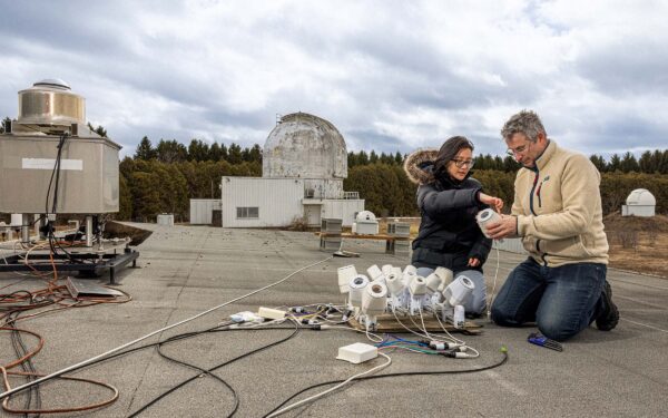
At Elginfield Observatory, just north of London, Ont., the work looks almost deceptively simple: a collection of cameras, some cables and the sky—albeit cloudy on this particular day. But in the hands of researchers like technical specialist Michael Mazur and PhD candidate Tammy Do, the modest setup becomes part of a national effort to understand what’s happening far above it.
Originally built to track meteors, these 3D-printed, wide-field cameras (part of a nationwide network) are now pulling double duty, quietly logging the steady flow of satellites crossing Canadian skies. What appears as faint streaks of light are, in fact, data points feeding a growing, made-in-Canada system designed to monitor space in real time. Across the country, the network has already recorded hundreds of millions of observations, capturing the movement of more than 17,000 objects in low Earth orbit.
From southern Ontario to the High Arctic, the initiative—a collaboration between Western and Defence Research and Development Canada—offers some-thing rare: a continuous, sovereign view of space above Canada. In places like Eureka, Nunavut, these cameras can detect orbital ‘choke points’—invisible to most of the world but critical corridors where satellites cluster and the risk of collisions rises. “It’s exciting to be part of something that’s happening in real time,” says Do, an astronomy graduate student from Vancouver, B.C. “You’re working on a system that’s not just observing space but helping Canada navigate it and keep us all safe.”
Back on Earth at Elginfield, atop the roof of one of the service buildings, that urgency translates into hands-on work like fine-tuning instruments, checking alignments and watching the sky. It’s a reminder that even in an era of global networks and space surveillance, science still begins with people, cameras and a clear night.